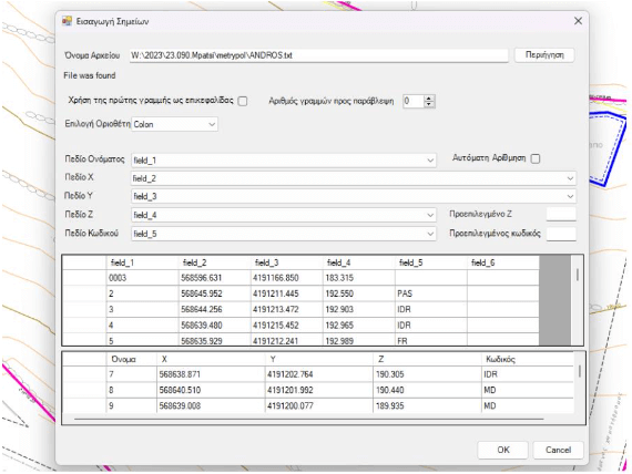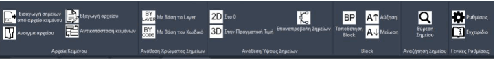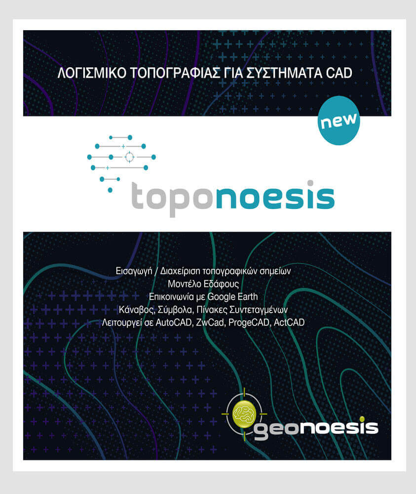
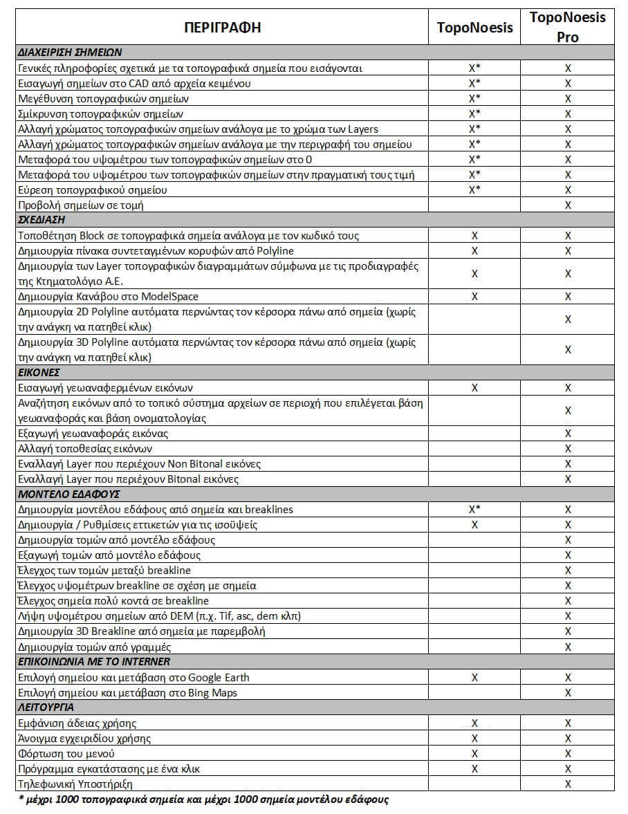
The basic version of the software (TopoNoesis) allows importing and editing points from text files in CAD software. For example, it can increase or decrease the size of imported points and change the color of each point according to its description. Other functions related to the points created include quickly finding a point, transferring points to their actual elevations or “zero,” and placing blocks on all points with the selected description by the user.
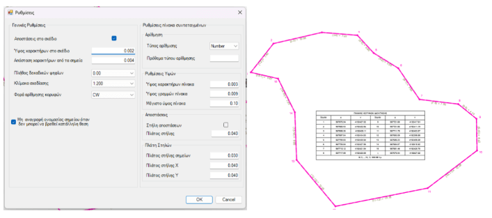
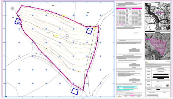
Furthermore, the user has the ability to create the necessary layers for each type of topographic diagram for electronic submission, to create coordinate tables for the selected polygon/line, to create a grid, to import georeferenced (and non-georeferenced) images (supports e-poleodomia images as well), and to select a point in CAD and have it transferred to the same point in Google Earth.
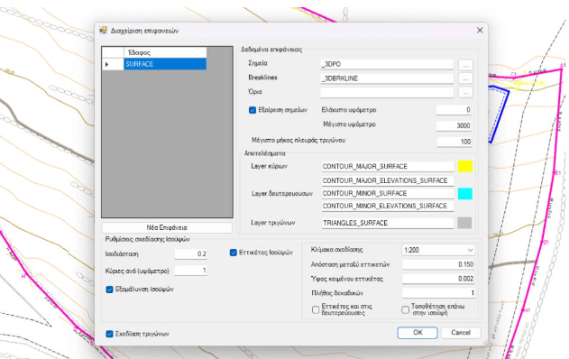
Finally, the user has the ability to create a terrain model from the points and polylines existing in the drawing, as well as to create contour labels on the generated contours.
In the basic version of the software, the number of topographic points and terrain model points that the software can handle is limited to 1000, a restriction that does not exist in TopoNoesis Pro, which supports a multitude of additional capabilities.